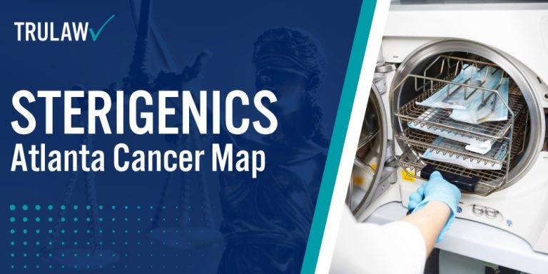
The Environmental Protection Agency’s 2018 National Air Toxics Assessment revealed alarming cancer risk levels in communities surrounding the Sterigenics facility in Smyrna, Georgia, prompting widespread concern among residents and health advocates.
This screening-level analysis identified specific census tracts near the medical sterilization plant where continuous exposure to ethylene oxide emissions over a 70-year period could substantially elevate cancer risks for residents living, working, and attending school in these areas.
Census Tracts with Highest Cancer Risk Levels
The EPA’s National Air Toxics Assessment identified two census tracts in the Smyrna area with elevated cancer risk levels exceeding federal safety thresholds.
According to the EPA’s Inspector General follow-up report shared with the Georgia Department, these census tracts were among 25 communities nationwide flagged for having potentially the highest cancer risks from ethylene oxide emissions based on 2014 emissions data.
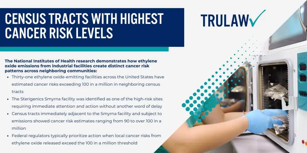
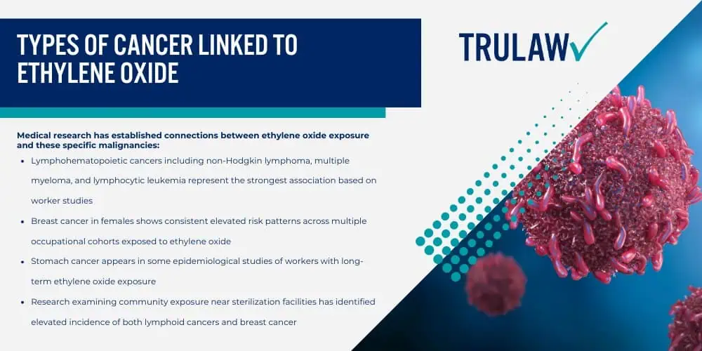
The National Institutes of Health research demonstrates how ethylene oxide emissions from industrial facilities create distinct cancer risk patterns across neighboring communities:
- Thirty-one ethylene oxide-emitting facilities across the United States have estimated cancer risks exceeding 100 in a million in neighboring census tracts
- The Sterigenics Smyrna facility was identified as one of the high-risk sites requiring immediate attention and action without another word of delay
- Census tracts immediately adjacent to the Smyrna facility and subject to emissions showed cancer risk estimates ranging from 90 to over 100 in a million
- Federal regulators typically prioritize action when local cancer risks from ethylene oxide released exceed the 100 in a million threshold
The cancer risk calculations reflect potential lifetime exposure assuming a person lives continuously in the affected area for 70 years.
These elevated risk estimates generated concern that prompted Georgia Environmental Protection Division officials to conduct additional air quality monitoring and require emission reduction technologies at the Sterigenics facility.
If you or a loved one lived, worked, or attended school near the Sterigenics Smyrna facility and have been diagnosed with cancer, you may be eligible to seek compensation.
Contact TruLaw using the chat on this page to receive an instant case evaluation and determine whether you qualify to join others in filing an Ethylene Oxide Lawsuit today.
Geographic Spread and Affected Neighborhoods
The ethylene oxide emissions from the Sterigenics Smyrna facility impacted multiple residential and commercial areas across Cobb County and parts of Fulton County.
The Sterigenics plant, located on Plant Atkinson Road in Smyrna, has operated as a medical device sterilization facility since the early 1970s, using ethylene oxide gas to sterilize healthcare equipment and supplies for its customers.
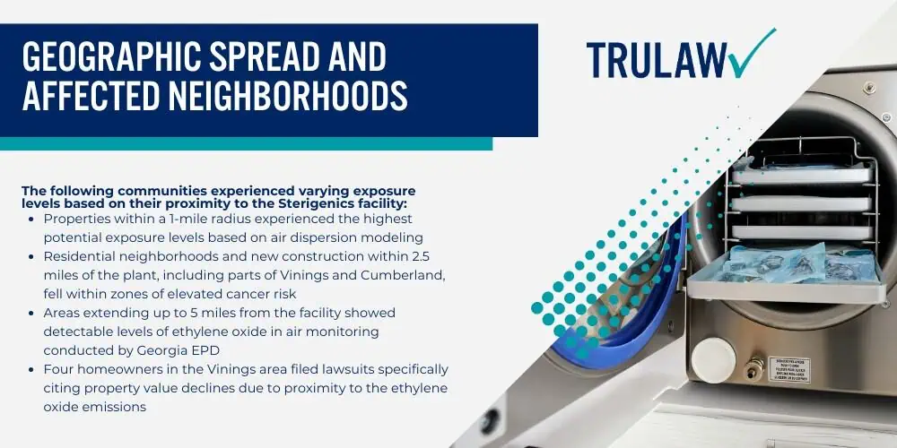
The following communities experienced varying exposure levels based on their proximity to the Sterigenics facility:
- Properties within a 1-mile radius experienced the highest potential exposure levels based on air dispersion modeling
- Residential neighborhoods and new construction within 2.5 miles of the plant, including parts of Vinings and Cumberland, fell within zones of elevated cancer risk
- Areas extending up to 5 miles from the facility showed detectable levels of ethylene oxide in air monitoring conducted by Georgia EPD
- Four homeowners in the Vinings area filed lawsuits specifically citing property value declines due to proximity to the ethylene oxide emissions
The geographic spread of ethylene oxide depends on multiple environmental factors that affect how the chemical disperses through the atmosphere.
According to the EPA’s guidance on ethylene oxide, there is no simple answer to how far away is safe, as wind speed, temperature, humidity, and other weather conditions substantially impact both the distance ethylene oxide travels and its concentration levels at various locations.
The volatile nature of ethylene oxide means it does not persist indefinitely in the environment, with an estimated atmospheric half-life ranging from 69 days during summer months like June to 149 days during winter months.
Georgia EPD positioned air quality monitors throughout Smyrna, Cobb County, and Atlanta to assess actual ethylene oxide concentrations in ambient air samples.
While 80% of these monitors did not detect ethylene oxide, those that registered positive results confirmed the presence of the cancer-causing chemical in neighborhoods near the Sterigenics facility.
This monitoring data validated the EPA’s risk assessment findings and demonstrated to Georgia EPD officials that residents in certain locations faced genuine exposure to industrial ethylene oxide emissions.
If you or a loved one lived in neighborhoods near the Sterigenics facility in Smyrna, Vinings, or Cumberland and developed cancer or serious health conditions, you may be entitled to compensation.
Contact TruLaw using the chat on this page to receive an instant case evaluation and determine whether you qualify to join others in filing an ethylene oxide exposure lawsuit today.
Interactive Mapping Tools and Resources
The Environmental Protection Agency provides several digital mapping tools that allow residents to examine air toxics data and cancer risk estimates for their specific locations.
The AirToxScreen Mapping Tool enables users to display cancer risks, emissions data, and other air quality information on an interactive map that can be zoomed to neighborhoods and specific addresses of concern.
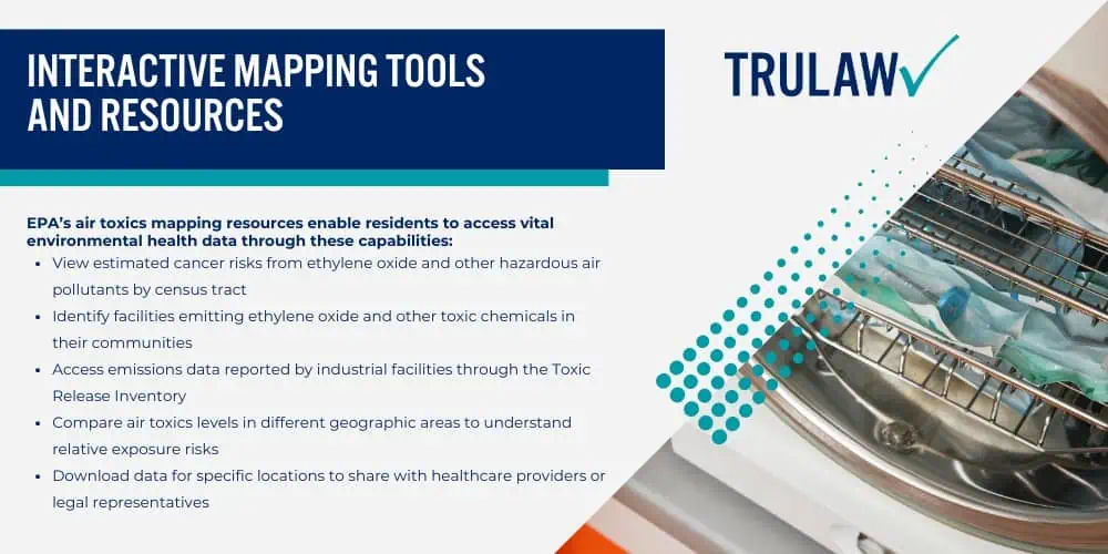
EPA’s air toxics mapping resources enable residents to access vital environmental health data through these capabilities:
- View estimated cancer risks from ethylene oxide and other hazardous air pollutants by census tract
- Identify facilities emitting ethylene oxide and other toxic chemicals in their communities
- Access emissions data reported by industrial facilities through the Toxic Release Inventory
- Compare air toxics levels in different geographic areas to understand relative exposure risks
- Download data for specific locations to share with healthcare providers or legal representatives
The Air Toxics Screening Assessment represents EPA’s screening tool designed to provide communities with information about health risks from air toxics.
As part of EPA’s approach to air toxics monitoring, AirToxScreen now provides updated data and risk analyses on an annual basis, helping state, local, and tribal air agencies, EPA staff, and concerned residents identify both existing and emerging air toxics issues in their communities.
However, residents should understand that AirToxScreen and similar mapping tools provide screening-level estimates rather than precise measurements of individual exposure.
The EPA emphasizes that these tools identify pollutants and areas requiring closer examination through additional monitoring and analysis.
Actual cancer risks in any given location may be higher or lower than the modeled estimates depending on various factors, including updated facility emissions information, installation of new pollution controls, changes in operations, and individual lifestyle factors affecting exposure duration and intensity.